Posts

Showing posts from 2011

December 2011 Newsletter

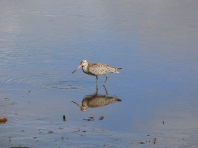
Happy Holidays and Season’s Greetings to all Friends of Stradbroke Island! Friends of Stradbroke Island Dec 2, 5:38 PM The FOSI Committee thanks you for your support in 2011 and looks forward to working with you in 2012 to preserve our beautiful island. Is your newsletter still arriving by post? If you’d prefer to receive it by email, please send your email address to Edith McPhee at emcphee@westnet.com.au. Thank you. Check out our new blog! This edition and new stories will be posted to http://   Read more… Spring Wildflowers Friends of Stradbroke Island Dec 2, 5:37 PM The spring wildflowers depicted below were photographed growing alongside the Blue Lake Track in September 2011 by Gail Quinn and Mary Barram. Forest boronia Guinea flower (hibbertia salicifolia) Phyllota phillicodes Agiortia pedicellata   Read more… Big picture protection Friends of Stradbroke Island Dec 2, 5:35 PM There are numerous threats to waders in Austr

Happy Holidays and Season’s Greetings to all Friends of Stradbroke Island!

Image
The FOSI Committee thanks you for your support in 2011 and looks forward to working with you in 2012 to preserve our beautiful island. Is your newsletter still arriving by post? If you’d prefer to receive it by email, please send your email address to Edith McPhee at emcphee@westnet.com.au. Thank you. Check out our new blog! This edition and new stories will be posted to http://www.fosi.org.au and over time back issues may also become available. Enjoy :)

Spring Wildflowers

Image
The spring wildflowers depicted below were photographed growing alongside the Blue Lake Track in September 2011 by Gail Quinn and Mary Barram. Forest boronia Guinea flower (hibbertia salicifolia) Phyllota phillicodes Agiortia pedicellata

Big picture protection

Image
There are numerous threats to waders in Australia and in other countries of the flyway. In many parts of South-east Asia the birds are hunted and there is widespread habitat loss through coastal reclamation and industrial development, especially in China and South Korea. In Queensland, there is inadequate protection of roost and feeding sites and threats from pollution. The elusive Beach Stone Curlew photographed on Frenchman’s Beach  Australia is a signatory to international treaties aimed at protecting migratory waders including the Ramsar Convention (Convention on Wetlands of International Importance especially as Waterfowl Habitat) which promotes wetland conservation, and the Bonn Convention (Convention on the Conservation of Migratory Species of Wild Animals) which provides a multinational framework for the conservation of migratory species. In the East Asian-Australasian flyway, 15 of the 22 countries in the flyway have signed the Ramsar Convention.  Australia also has sp

Looking after Straddie’s Shorebirds – we all have a role to play

Image
Shorebirds are very easily disturbed by close activity. A disturbance is any action that interrupts the breeding, feeding or resting of shorebirds. For example, causing a shorebird to take flight represents a significant disturbance. When shorebirds take flight they use critical energy that is required for migration and breeding. Repeated disturbances and disturbances that occur before or after migration are particularly damaging for shorebirds. Without sufficient energy reserves shorebirds may be unable to complete their migration or breed. Vehicles driven over Home Beach to the detriment of shore birds and their habitat We can all help prevent shorebird disturbance by following these guidelines: Keep dogs and cats under control and well away from shorebirds. Every time shorebirds are forced to take flight, they burn vital energy. Avoid driving or operating all forms of vehicles, vessels and recreational devices near shorebirds. Use 4 wheel drive vehicles only where permitted

Where to see Shorebirds on Straddie?

Image
For a good look at shorebirds, sit quietly at a distance and study them through binoculars or a spotting scope. Disturbance from boats, people and dogs is a problem and these sites are best viewed out of the holiday season. Sooty Oystercatchers on the rocks at Frenchman’s Beach   Amity and Flinders Beach  One of the best places to see Straddie’s migratory shorebirds is on the Amity sandbanks at the north-western end of the village where the birds roost at high tide and on the exposed mudflats at low tide. Many thousands of waders and terns are sometimes present in summer. Bar-tailed Godwit and Grey-tailed Tattler are usually very abundant, while Whimbrel and Eastern Curlew are common. From February to August, the Double-banded Plover from New Zealand can be sometimes sighted at Amity but more often at Flinders Beach.  Amity is also a great place to see resident shore and water birds such as bush stone-curlew (especially at dusk in the camp grounds), red-capped plover, Creste

Foreign Feathered Friends

Image
It seems that the plight of immigrants and how Australia should welcome - or reject - them has dominated the news for months lately. While all this has been going on North Stradbroke Island has been quietly providing a temporary home to thousands of undocumented and hungry arrivals. Beginning in early September, Amity Point, 18 Mile Swamp and other wetlands across Straddie and throughout Moreton Bay have been providing a temporary refuge to thousands of migratory shorebirds. Shorebirds, also known as waders, are a diverse group of birds commonly seen feeding in intertidal areas or on the fringes of freshwater wetlands. They generally have long legs in relation to their body size, no webbing on their feet and they do not swim. But they can certainly fly! Bar Tailed Godwit on Home Beach. Most of the migrants spend the months of June and July on their breeding grounds in the northern parts of Siberia, Alaska, China and Mongolia. They breed in areas where melting snow brings mass

Urban Koala Survey 2011

Image
We were woken early on Saturday 15 October by a storm which eased as we headed for Cleveland and the water-taxi to Dunwich to take part in the 2011 North Stradbroke Island Urban Koala survey, organised by RCC Wildlife. There were about 30 volunteers this year and we surveyed the streets of each township in small groups, beginning at Dunwich. Here we found 10 koalas; then to Amity Point where we found 19 plus 1 at Flinders Beach. After lunch on the shore at Amity we surveyed Point Lookout but sighted only 1 koala there, a grand total of 31 for this year – 3 higher than last year. Where were the koalas which we know have been seen at Point Lookout? There have been photos and records of them and locals told us they have seen them but they seemed to be hiding away on the survey day! However, it was a good day; even the weather smiled on us – sunny and warm after the morning storm and then a magnificent storm brewing at the end of the day as we boarded the water-taxi back to Cleve

Moreton Bay 2011 Water Quality Report Released

Image
The Healthy Waterways 2011 Ecosystem Report Card was released last month providing an insight into the health of South East Queensland’s waterways and Moreton Bay. The results show the full force of the flood with water quality deteriorating due to the significant amount of sediment and nutrients that have flowed into the bay from catchments. Three of the region’s five catchments flowing into the bay scored F (which means “Conditions do not meet set ecosystem health values; most key processes are not functional and most critical habitats are severely impacted”) and Central Bay, Deception Bay and Bramble Bay scored D+, D+ and D-. The good news is, in spite of Southern Moreton Bay scoring F, the water around Stradbroke Island is generally of a superior quality. The Eastern Banks scored A- and Eastern Bay scored B- while Waterloo Bay scored B+. There have however been reports of increasing mortality rates for dugongs and turtles and oyster farmers have had to remove barnacles t

National Park & Mining - Compatible?

Image
Sourced from the Financial Review 09/09/2011 The Proposed National Park The government’s vision for North Stradbroke Island includes declaring further national park by the end of 2011. The area to be added to that declared in March this year will result in approximately 50% of the island becoming national park. While any declaration of any area as national park is obviously something we welcome because it enhances protection, how much credit does the government deserve? The new national park will in fact bear a close resemblance to the proposed national park map published in the mining company's own documents for a number of years, including in CRL's draft Enterprise Environmental Studies Report in 2002. The same map has also been regularly published in official company documents since. It is worthwhile comparing that map with the latest DERM national park map. Go to www.savestraddie.com to view both maps, under the 'library' tab. Unfortunately, a significant propo

In brief (July 2011)

Recent Research Recent reasearch from Griffith University indicates that the freshwater shrimp Caridina indistincta and a sympatric freshwater fish Rhadinocentrus ornatus , found only on the East coast of North Stradbroke Island, have genetic heritage dating from the Pleistocene era (~ 100-300 thousand years ago). Interestingly, this coincides with most estimates of the age of the dunal landscapes and indicates just how ancient and unique the island is. Holiday House Letting Code Continuing complaints from residents at Point Lookout about noisy behaviour from neighboring holiday tenants have caused the Redland Council to consider regulation of letting in residential areas. At the moment the Voluntary Code of Practice applying to agents is mostly effective but partying tenants in some houses, let by one agent, have frequently come to the attention of police. At the last round table discussion called by Mayor Melva Hobson residents, including FOSI representatives, voiced their concerns.

National Park Declaration Map

Image
North Stradbroke Island National Park Declaration Map

Native Title Determination Areas

Image
North Stradbroke Island Native Title Determination Areas

Criminal charges against Sibelco adjourned again

The company was charged in December 2009 with three summary offences alleging it did not have permits authorising it to remove and sell large quantities of non-mineral sand for landscaping and other purposes. The Court of Appeal has already confirmed that the actions were unlawful. However the company's criminal responsibilty has not been determined. Last month Unimin/ Sibelco was back in the Brisbane Magistrates court for 2 days, this time arguing that the prosecution against it is an abuse of process. The argument continues on November 7, with 3 more days set aside. It will then be almost 3 years since evidence was seized in a raid on Unimin's premises by the defunct EPA and two years since the charges were laid, an unusual delay in the initial hearing of summary charges in the Magistrates Court. Meanwhile, the government still refuses to send all of the evidence to the DPP for assessment of more serious charges, despite senior counsel opinion that there is a prima facie case

North Stradbroke Island Protection and Sustainability Act 2011

As members are well aware, FOSI (and SIMO) have campaigned for the application of the Mineral Resources Act to the expired mining leases, especially the Enterprise Mining Lease 1117 which expired in 2007. With this new NSI Act, the government has bypassed the existing law to extend expired leases. All other expired mining leases in Queensland remain subject to the Mineral Resources Act. The provisions of the MRA, if applied, would not allow more mining to take place on land earmarked for National Park (i.e. at Enterprise Mine and Vance Mine where expired leases were also extended by the Act). The government claims the NSI Act will bring certainty to the ending of mining but it only extended mining onto land it intends to make National Park after it is environmentally devalued. Our two legal opinions can be read on the save straddie website, again under the library-resources tab. FOSI calls on the Queensland Government to amend the relevant sections (Section 11 and Schedule 1) of the NS

January floods and bay health

The January floods have sparked serious concern over the impact of sediment plume on seagrasses, turtles and dugongs in Moreton Bay. With the Port of Brisbane reporting an additional 1 million m3 washed down the river as a result of the flood, there has been a need to check the effect this has had on the bay inhabitants. Green Sea Turtles and Dugongs feed on the seagrasses that thrive in the shallow sand banks and there is a fear that the flood plume may have reduced their food source significantly. Fortunately, according to Healthy Waterways, intial observations have proven positive and the existing dugong and turtle populations appear to be in good condition. Find more information at www.healthywaterways.com.au

An end to sand mining, why 14 years and not 6 weeks?

Image
Sand mining stopped on Fraser Island in 6 weeks! Why does this government need 14 years? In 1976 the Fraser government stopped sand mining in just 6 weeks after banning exports of mineral sand from the island. In contrast, the Bligh Government have enacted laws to extend mining on Stradbroke for 14 more years, sidestepping future use provisions of the Mineral Resources Act, which applies to every other mine in Queensland. There were cries of gloom and doom and loss of jobs in 1976 just as we are hearing now at Stradbroke. But what happened at Fraser Island? A successful eco-tourism industry was developed, attracting people from all over the world to the World Heritage listed largest sand island in the world. The Fraser Coast has become a thriving residential and tourism area on the back of the island’s fame. No one, I’m sure, has ever looked back wistfully saying ‘if only sand mining had been allowed to continue our lives would have been better’. Stradbroke Island will prosper on

Erosion at Amity and Point Lookout

Image
Deadman's Beach at its worst. Early this year, with the wild weather, dramatic erosion occurred once again at Amity and Point Lookout. In January a large chunk of the Amity foreshore fell into the Rainbow Channel, causing a worrying time for residents, while at Point Lookout all beaches were left denuded of sand and with a number of the fringing casuarinas undermined and collapsed. Erosion does seem to be gaining in intensity and needs to be taken seriously by the powers that be. Amity has a long history of drastic erosion with the settlement now 100 metres or so inland from where it was first established. On this occasion it was halted by the dumping of about 300 tonnes of rock along the shores. But there are varying views on the long–term prospects and possible remedies and concern about Council consideration of a “planned strategic retreat” strategy. The Redland City Council is currently developing a Shoreline Erosion Management Plan for Amity. 
There is no such plan for the

Marine Plastic Kills Seabirds

Image
Sea birds which forage in the Tasman Sea are eating plastic, thinking it is food and are dying in large numbers on Lord Howe Island. Large amounts of plastic are found in the stomachs of shearwaters and one survey found more than 200 pieces in one bird alone and up to 50 in others. The plastics have very sharp edges and tear their internal organs. Toxic substances bind to this plastic, and mercury, toxic to birds at 4 parts per million, was found to be as high as 30,000ppm. 95% of nesting shearwaters on Lord Howe Island were found to have plastic in their stomachs. It was thought that the huge N Pacific garbage patch or gyre north of Hawaii, which gathers plastics from N America and Asia, was the source of their problem but the migratory birds had none in their stomachs when they arrived in September. From Lord Howe, they forage in the Tasman Sea off the coast of NSW, Vic and Tasmania and a few months later are found to be full of plastic. The shearwater numbers have halved since 1970

The Eighteen Mile Swamp

Image
Swamps fringe the Northern, Eastern and Southern shores of North Stradbroke Island. The Eighteen Mile Swamp, a great trough in the sand lying seaward of the huge dunes of the main sand mass is kept full of fresh water by seepage from the sand mass rather than surface run off. Straddie is the southernmost high dune sand mass in Australia and the second–largest sand island in the world after the World Heritage Listed Fraser Island. This swamp teems with life and interest and is so special that it is included within the Moreton Bay RAMSAR site, recognised as one of the world’s premier wetlands. It is in fact the longest wetland of its type in the world. Eighteen Mile Swamp It is only this year that it has finally been given the highest form of regulatory protection available in Queensland by being declared National Park. The park has been named NAREE BUDJONG DJARA  by indigenous people on the island who are engaged in its joint management with the state. This level of protection has

High Court Victory

Image
In the High Court of Australia in Canberra on June 9 the mining company’s final attempt to prolong the mining industry on Stradbroke for another 100 years was rejected. This brings to an end the company's plan to remove and sell large quantities of island sand for construction purposes. The new NSI legislation at least prevents any future application for Council approval. FOSI, SIMO, native title owners, other conservationists and members of the local community waged a lengthy legal battle and were rewarded with a significant victory. This proposal involved noisy and polluting trucks roaring through the streets of Dunwich and clogging up the ferry terminal entry point, at a rate of one every three minutes. It also would have meant continued domination of the island by the mining industry long after extractable minerals had run out. All this impact on safety and peace of islanders and tourists was for the sake of ten jobs! (This figure was contained in the company’s application for